File:Lost-lands-map-political-1287pr.png
Jump to navigation
Jump to search
Size of this preview: 600 × 599 pixels. Other resolution: 716 × 715 pixels.
Original file (716 × 715 pixels, file size: 18 KB, MIME type: image/png)
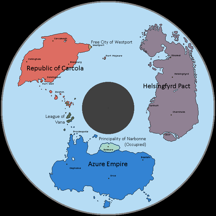
A map of the known world of Izaria in the year 1287 PR.
File history
Click on a date/time to view the file as it appeared at that time.
| Date/Time | Thumbnail | Dimensions | User | Comment | |
|---|---|---|---|---|---|
| current | 21:12, 18 June 2025 | | 716 × 715 (18 KB) | Bfox (talk | contribs) |
You cannot overwrite this file.
File usage
The following page uses this file: