File:Westport Wiki Map.png
No higher resolution available.
Westport_Wiki_Map.png (250 × 135 pixels, file size: 1 KB, MIME type: image/png)
Summary
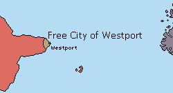
The location of the Free City of Westport in the world. The eastern part of the Republic of Carcola and the Moragan Islands are also visible.
File history
Click on a date/time to view the file as it appeared at that time.
| Date/Time | Thumbnail | Dimensions | User | Comment | |
|---|---|---|---|---|---|
| current | 19:08, 5 July 2025 | | 250 × 135 (1 KB) | Bfox (talk | contribs) | Resized |
| 19:05, 5 July 2025 | 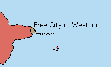 | 227 × 138 (970 bytes) | Bfox (talk | contribs) | The location of the Free City of Westport in the world. The eastern part of the Republic of Carcola and the Moragan Islands are also visible. |
You cannot overwrite this file.
File usage
The following page uses this file: