File:Carcola Wiki Map.png
No higher resolution available.
Carcola_Wiki_Map.png (327 × 271 pixels, file size: 2 KB, MIME type: image/png)
Summary
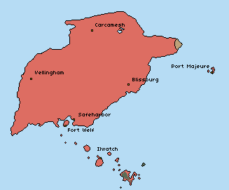
A map of the Republic of Carcola in 1287 PR with major cities noted. Terra incognita is colored black in the bottom right of the image.
File history
Click on a date/time to view the file as it appeared at that time.
| Date/Time | Thumbnail | Dimensions | User | Comment | |
|---|---|---|---|---|---|
| current | 18:27, 29 June 2025 | | 327 × 271 (2 KB) | Bfox (talk | contribs) | Removed terra incognita from this map |
| 17:19, 29 June 2025 | 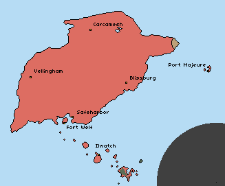 | 327 × 271 (2 KB) | Bfox (talk | contribs) | A map of the Republic of Carcola in 1287 PR with major cities noted. Terra incognita is colored black in the bottom right of the image. |
You cannot overwrite this file.
File usage
The following page uses this file: